Site surveying in Northfleet and Ebbsfleet covers the measured assessment of land, ground conditions and existing features before building work begins. Because much of this area sits on reworked chalk-pit and cement-works land, surveys here tend to combine topographical measurement, ground investigation and careful checking of historic site use rather than a single straightforward survey.

Why this corner of north Kent draws so much survey activity
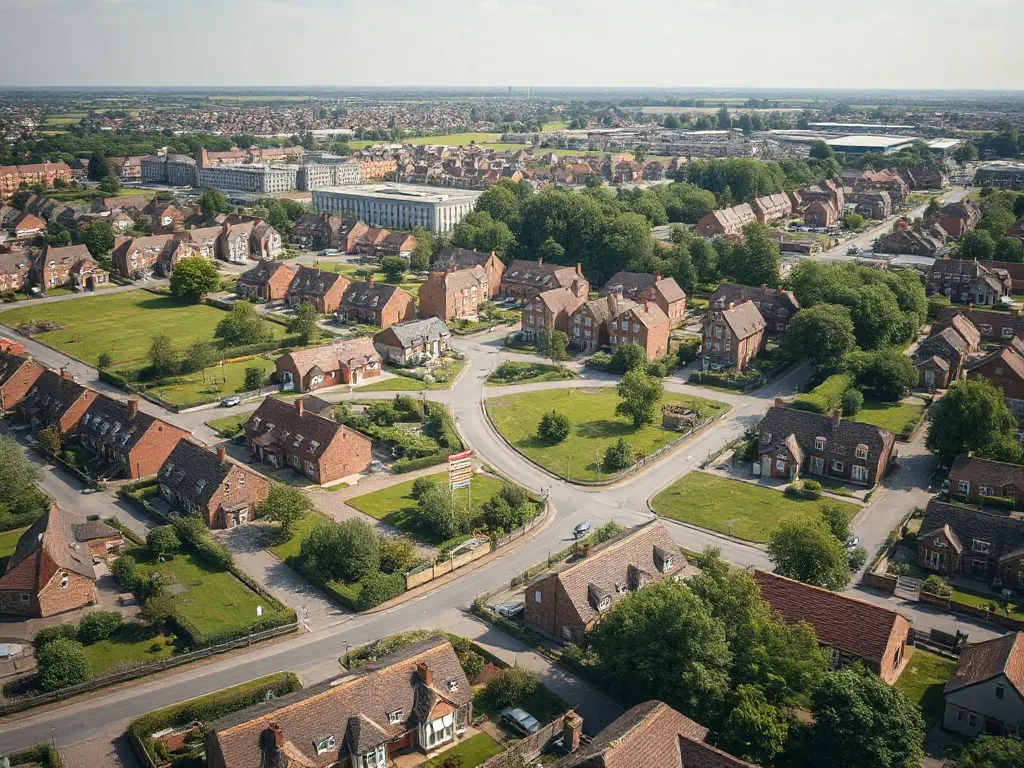
The Ebbsfleet Garden City programme is one of the largest planned developments in the South East, with thousands of new homes, schools and commercial spaces being delivered across former industrial land between Northfleet, Ebbsfleet and Swanscombe. That scale of construction generates a steady demand for survey work at every stage, from initial land appraisal to setting out individual plots.
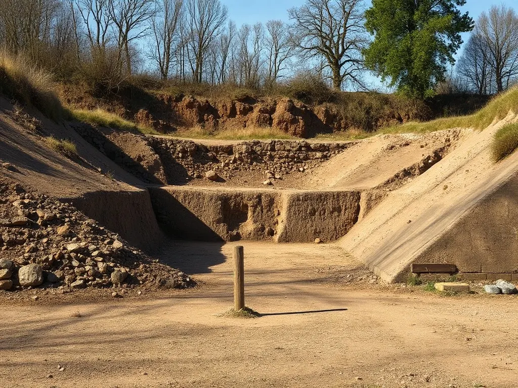
The land itself adds complexity. Cement production and chalk extraction shaped the local landscape for well over a century, leaving deep voids, steep quarry faces and large areas of made ground (soil and material deposited by previous works rather than laid down naturally). Surveyors working here are rarely dealing with a flat, undisturbed greenfield site.
Former chalk pits, quarries and made ground
Site surveying in Northfleet and Ebbsfleet covers the measured assessment of land, ground conditions and existing features before building work begins.
The disused chalk pits around Northfleet are the defining feature for anyone assessing the ground. Some have been backfilled with mixed material over decades, which can settle unevenly and affect how foundations are designed. Old quarry edges may need stabilising, and groundwater behaviour through chalk can be unpredictable.
A ground investigation typically combines boreholes, trial pits and sampling to establish what lies beneath the surface and how deep the made ground extends. On former cement-works land, soil testing also checks for contamination linked to past industrial processes. The findings feed directly into a structural engineer's foundation design and into any remediation a planning authority requires before development.
Useful questions to raise early about a site of this kind include:
- What is the depth and composition of any made ground?
- Are there voids, old shafts or unstable quarry faces nearby?
- Has the land been screened for contamination, and to what standard?
- How does groundwater move through the chalk beneath the plot?
Topographical surveys before a planning submission
A topographical survey records the exact shape and detail of a site — levels, boundaries, existing structures, trees, drainage and services. For planning applications in the Ebbsfleet growth area and across Gravesham, an accurate topographical survey is usually expected to support proposed layouts and demonstrate how a scheme sits within its surroundings.
Where ground levels vary sharply, as they often do near old quarry edges, the survey captures these changes precisely so that cut-and-fill, retaining walls and access gradients can be designed realistically. The data is typically supplied as a scaled drawing tied to Ordnance Survey coordinates, which architects and engineers then build their proposals upon. Getting this right at the outset reduces the risk of design changes once an application is in front of the local authority.
Plot layout and setting out across the new neighbourhoods
Garden city planning emphasises generous green space, clear street patterns and a defined relationship between homes, gardens and public areas. Translating an approved masterplan into physical reality on the ground is the role of setting out: marking the precise position of each plot, road, service run and building line so construction follows the design exactly.
On large phased sites, setting out is an ongoing process rather than a single visit, with surveyors returning as each parcel of land is brought forward. Accurate control points established early allow successive contractors to work to a consistent reference, which matters when many plots share boundaries, shared drives and coordinated street frontages. Errors at this stage are expensive to correct later, so the measured discipline of setting out underpins the whole build.
Last reviewed: June 2026