A measured building survey is a precise, scaled record of an existing building, captured on site and turned into accurate drawings such as floor plans, elevations and sections. It documents what is actually there — wall positions, room sizes, openings, levels and key features — rather than what was once intended, giving architects, engineers and owners a reliable basis for design, valuation or planning decisions.
What a measured building survey actually is
A measured building survey is the process of recording the geometry of a building to a stated accuracy and presenting it as dimensioned, scaled drawings. The word "measured" is the important part: every line on the resulting plan corresponds to a real measurement taken on site, not an estimate or a copy of old paperwork.
It differs from other surveys you might come across. A condition or building survey assesses the state of repair and flags defects; a valuation survey estimates worth; a topographical survey maps the land and external levels. A measured building survey is concerned with dimensions and layout — the size, shape and arrangement of the structure itself, inside and out.
The output is usually supplied as digital CAD files (computer-aided design drawings that can be edited and scaled) and often as PDFs. The level of detail is agreed in advance, because a survey can be coarse enough to show overall room layouts or fine enough to record cornices, skirtings and individual window glazing bars.
The drawings it delivers
A measured building survey is a precise, scaled record of an existing building, captured on site and turned into accurate drawings such as floor plans, elevations and sections.
The drawings are the product of the survey, and the brief usually specifies which are required. The common deliverables are described below.
- Floor plans — a horizontal "slice" through each storey, typically cut at around 1.2 metres above floor level, showing walls, doors, windows, stairs, fixtures and room dimensions. They are the most frequently requested drawing and form the backbone of most design work.
- Elevations — flat, face-on views of the outside (and sometimes inside) walls. They record window and door positions, heights, materials, rooflines and features such as string courses or chimney stacks. Elevations are essential for planning applications and for understanding how a building reads from the street.
- Sections — vertical "cuts" through the building that reveal floor-to-floor heights, roof construction, changes in level and the relationship between storeys. A section answers questions a plan cannot, such as headroom under a sloping roof.
- Reflected ceiling plans — a view of the ceiling as if it were mirrored onto the floor, showing the layout of beams, lighting, vents, sprinklers and ceiling features. These are valuable in commercial fit-outs and in buildings with ornate ceilings.
Other drawings can be added to the package, including roof plans, site plans tying the building to its boundaries, and detailed records of mouldings or joinery for listed and historic properties. The scale matters: plans are commonly produced at 1:50 or 1:100, with details drawn larger so fine features remain legible.
When it is the right choice
A measured building survey is worth commissioning whenever decisions depend on knowing the real dimensions of a building. Working from inaccurate or missing drawings is a common cause of design errors, abortive work and disputes later on.
Typical situations include:
- Extensions, conversions and refurbishments, where new work must fit precisely against the existing structure.
- Planning and listed building applications, which usually require accurate existing-condition drawings before proposals can be assessed.
- Space planning and lease management, where reliable floor areas affect rent, business rates or how a space is let.
- Heritage recording, capturing a historic building's form before alteration or as a permanent archive.
- Party wall and boundary matters, where exact positions and heights need to be documented.
If only a rough sketch or a single dimension is needed, a full survey may be more than the task requires. But where multiple parties will rely on the same drawings, or where construction will follow, the accuracy of a measured survey usually repays its cost by preventing mistakes.
How surveyors capture the building
The method chosen depends on the size, complexity and required accuracy of the building. Most firms now combine several techniques rather than relying on a tape measure alone.
Laser scanning is widely used for detailed or complex jobs. A 3D laser scanner sweeps the space and records millions of measured points — a "point cloud" — capturing geometry far faster and more completely than manual methods. The point cloud is then used in the office to draw plans, elevations and sections, and to model the building in three dimensions if needed.
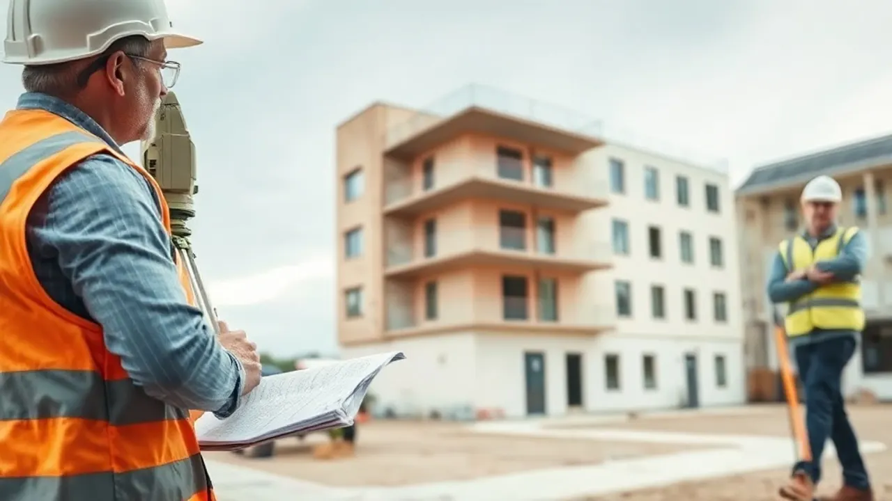
Total stations — survey instruments that measure angles and distances to a target — are used to fix control points and tie the building into a consistent coordinate framework. This control ensures that separate scans and measurements line up correctly across a large or multi-storey property.
Disto and hand measurement still has a place. A handheld laser distance meter records individual dimensions quickly, and traditional measuring is used to check details and reach awkward spots. Heights of features such as eaves and chimneys may be recorded by scanner, total station or, where access allows, by other survey methods.
The on-site stage is only part of the work. The captured data is processed and drawn up in CAD to the agreed standard, with conventions for line weights, layers and labelling so the drawings are usable by other professionals. Before commissioning, it is sensible to ask a surveyor about the accuracy tolerance, the scale and detail to be delivered, the file formats supplied, and how access to occupied or restricted areas will be arranged. Clarifying these points early avoids surprises and ensures the finished drawings match the purpose they are needed for.

Reviewed: June 2026