3D laser scanning is a survey method that captures the geometry of a building, structure or site as millions of precisely measured points, recorded by an instrument that sweeps a laser across every visible surface. The result is a point cloud — a dense digital representation that can be measured, modelled and viewed long after the survey team has left site. It is used where traditional tape-and-theodolite measurement would be too slow, too risky or not detailed enough.
What 3D laser scanning is
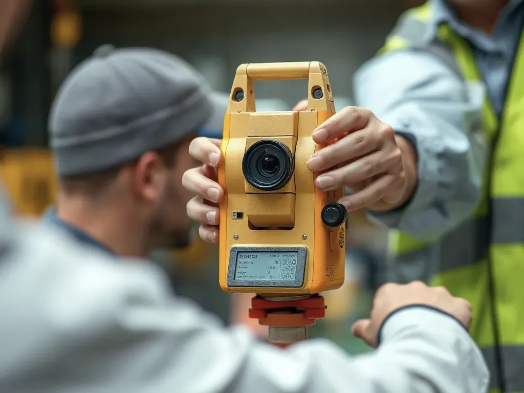
A laser scanner sits on a tripod and rotates, firing a laser beam that reflects off surfaces around it. By measuring the time the beam takes to return (or the phase shift of the reflected light) and the angle at which it was sent, the instrument calculates the exact position of each point relative to itself. A single scan position can record tens of millions of points in a few minutes.
Because one scan only "sees" what is directly visible from where the scanner stands, surveys are taken from many positions and then stitched together. Each position is sometimes called a "setup" or "station". Most scanners also capture colour photographs at the same time, so the point cloud can be displayed in realistic colour rather than plain grey.
Two broad approaches exist. Terrestrial laser scanning uses a tripod-mounted instrument for fixed, high-accuracy capture. Mobile and handheld scanning, sometimes using SLAM (Simultaneous Localisation and Mapping, where the device tracks its own movement), is faster over large areas but generally less precise.
From point cloud to usable model
The result is a point cloud — a dense digital representation that can be measured, modelled and viewed long after the survey team has left site.
A raw point cloud is a collection of coordinates, not a drawing or a model. Before it is useful, the separate scans must be combined into one consistent dataset. This step is called registration: the software aligns overlapping points from different scan positions so that, for example, the same wall captured from three setups becomes a single surface rather than three slightly offset copies.
Registration can rely on natural features common to overlapping scans, on physical targets (printed spheres or checkerboards placed around the site), or on control points surveyed independently. Tying the cloud to a known coordinate system — site or national grid — lets the data sit correctly alongside other survey information.
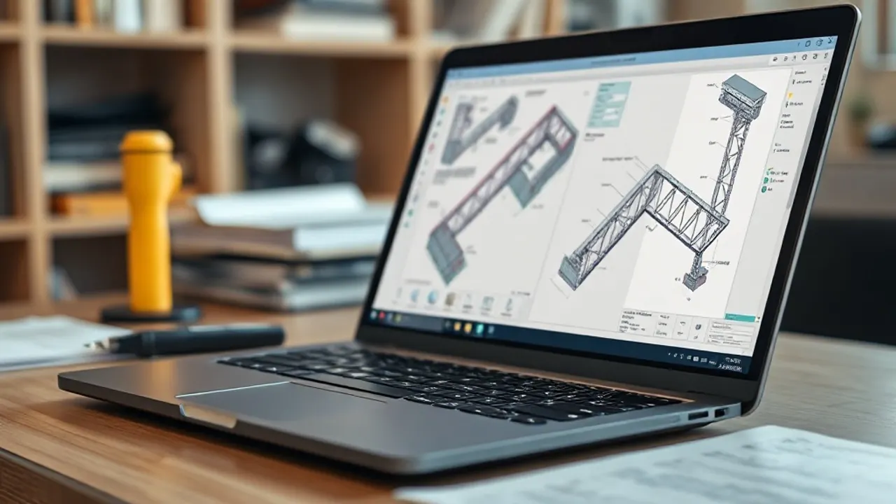
Once registered, the point cloud is turned into something a designer can work with. Common outputs include:
- 2D drawings — floor plans, elevations and sections traced from the cloud.
- 3D surface or mesh models for visualisation and clash detection.
- Scan-to-BIM, where the point cloud is used to build an intelligent model in which walls, floors, doors and services are modelled as objects with properties, not just lines.
Scan-to-BIM is largely a manual interpretation task. Software can speed it up, but a technician decides what each cluster of points represents and how accurately the model should follow the existing fabric. The agreed Level of Detail and tolerance — how closely the model matches reality — should be set out before work begins, because it drives both time and cost.
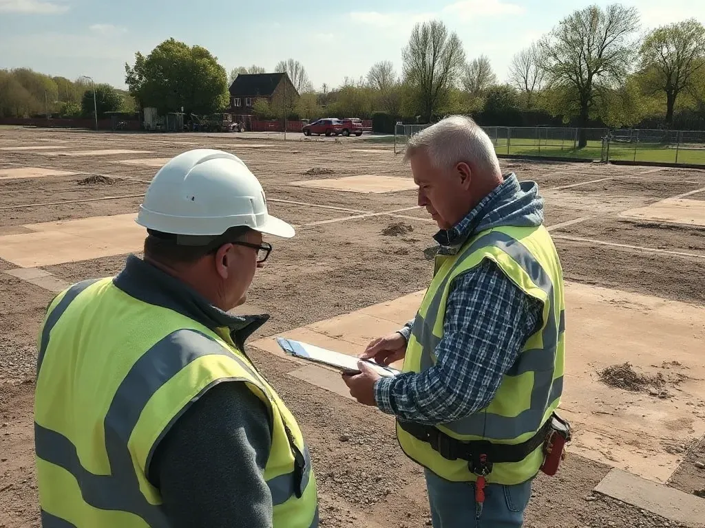
When scanning beats traditional measurement
Scanning earns its place where there is a lot of geometry, where access is awkward, or where rich, checkable data matters more than a few headline dimensions. Capturing everything in view also means measurements not requested at the time can still be taken later from the cloud.
Situations where it tends to be the stronger choice include:
- Complex or irregular structures — historic buildings, ornate facades, curved or distorted surfaces that defy simple measurement.
- Live or hazardous environments — plant rooms, industrial sites and busy roads where the scanner records from a safe distance.
- Refurbishment and retrofit, where designers need accurate as-built information rather than out-of-date drawings.
- Heritage recording, where a permanent, detailed record of the structure is valuable in itself.
- Coordination of building services in congested ceilings and risers.
For a single room, a simple plot, or a job needing only a handful of dimensions, conventional methods are often quicker and cheaper. The volume and density of point cloud data is an asset only if there is a reason to use it.
How precise a scan survey is
Modern terrestrial scanners can measure individual points to within a few millimetres at typical building ranges. The precision of the finished deliverable, however, depends on more than the instrument's specification.
Accuracy degrades with distance, with shallow angles of incidence, and on dark, shiny or reflective surfaces. The quality of registration matters too: small alignment errors between scans accumulate across a large or sprawling site, so good control and adequate overlap are important. A survey tied to surveyed control points will hold its accuracy better across a building than one registered on cloud features alone.
It is worth separating the accuracy of the point cloud from the accuracy of any model drawn from it. A model is an interpretation, and its tolerance is a decision, not a fixed property. A reader commissioning work should ask what accuracy is being quoted, whether it refers to the raw cloud or the deliverable, and how it will be verified.
Cost drivers and project scope
Pricing for scanning work usually reflects two distinct phases: time on site to capture the data, and time in the office to process it into the agreed outputs. Processing frequently costs more than the site visit, particularly for detailed models.
The main factors that move the price are:
- Size and complexity — more area and more intricate geometry mean more scan positions and longer processing.
- The required deliverable — a registered point cloud is cheaper than 2D drawings, which in turn are cheaper than a detailed scan-to-BIM model.
- Level of Detail and tolerance — a tighter, more fully modelled output takes considerably more effort.
- Access and site conditions — restricted hours, height, confined spaces or the need for traffic management add time and cost.
- Coordinate and control requirements — tying the survey to a grid involves additional setting-out.
A clear brief that states exactly which outputs are needed, in what format and to what tolerance, gives the most reliable basis for comparing quotations. Asking for more detail than the project actually uses is a common and avoidable expense.
Reviewed: June 2026